

Miranda-verktygets modeller
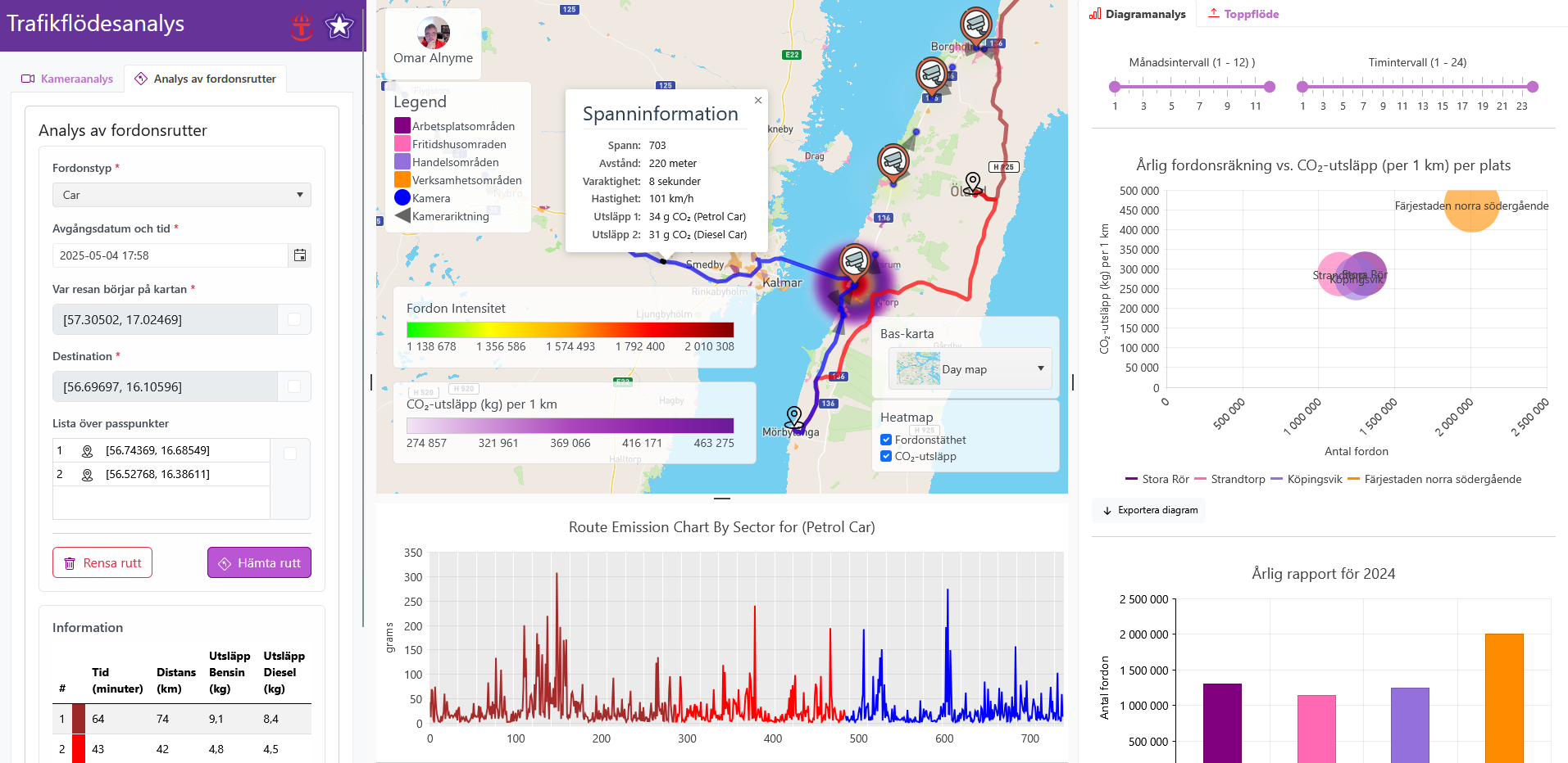
Trafikvolymer på vägen – Trafikflödesanalys
Our platform delivers traffic analytics solution leveraging data from Sweden’s nationwide network of traffic safety cameras (speed cameras), which capture vehicle passages with approximately 95% accuracy. The system enables multi-scale analysis, from individual camera locations to aggregated corridor-level assessments, while its advanced route analysis functionality calculates distance, duration, and vehicle-specific CO₂ emissions for any user-defined path – including optional waypoints. By integrating this high-precision traffic data with complementary datasets like tourism statistics, we provide actionable insights into traffic patterns, sector-specific environmental impacts (including tourism-related emissions), and evidence-based recommendations for sustainable mobility planning. This integrated approach supports data-driven decision making for transportation authorities, urban planners, and environmental agencies alike.
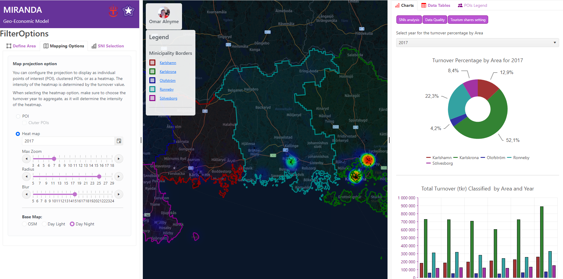
Turismens ekonomi på karta
This model utilizes financial data from businesses to assess and quantify tourism-related economic activity. Users can define study areas at various geographic scales, such as regions, municipalities, or custom-defined areas, through an interactive map interface. Additionally, the study area can be delineated based on travel distance within a specified time frame and mode of transportation, enabling a more precise spatial analysis of tourism’s economic impact.
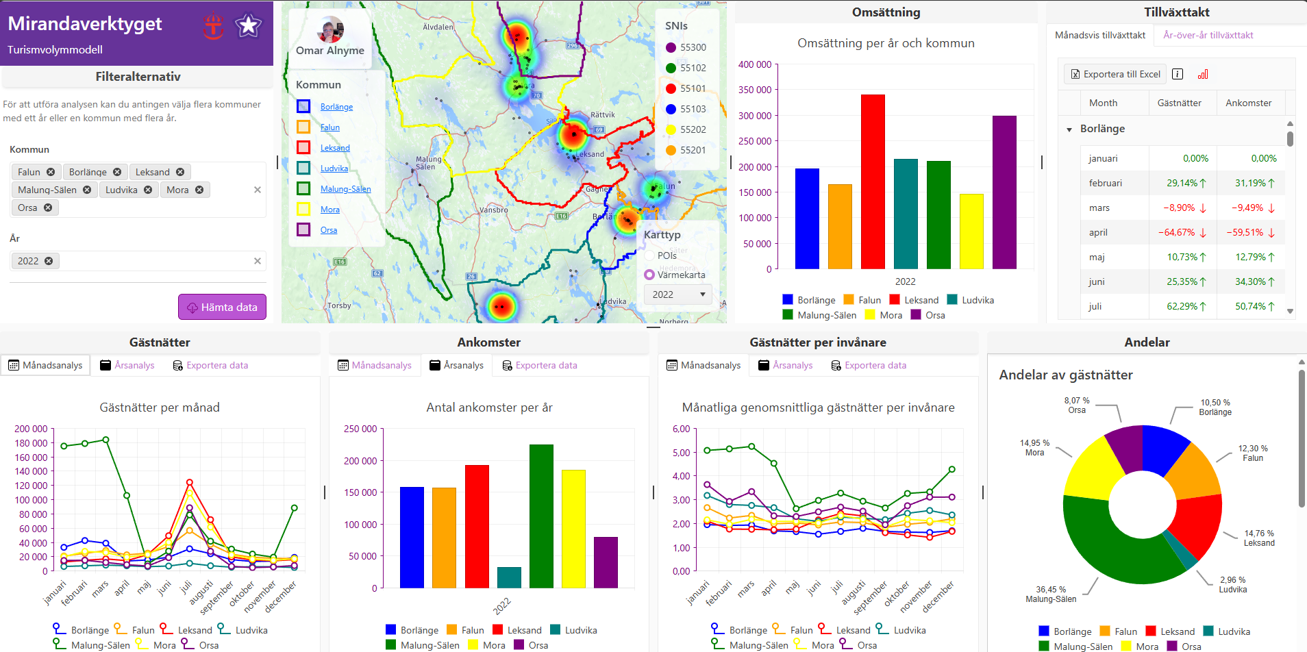
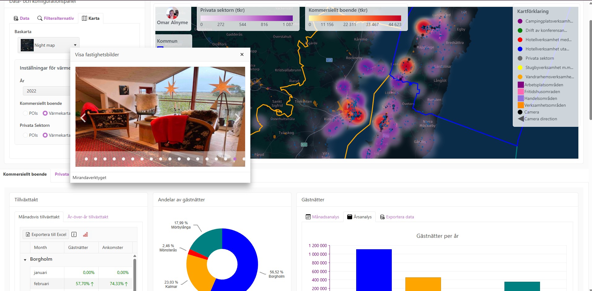
Gästnätter
The model is designed to integrate data from lodging facilities and business registries, enabling analysis of tourism activity and its economic impact. By consolidating information from these sources, the system provides granular insights at the municipal level, delivering key performance indicators (KPIs) such as guest nights, tourist arrivals, average length of stay, annual and monthly growth rates, and the distribution of tourism-oriented businesses.
This integrated approach facilitates comparative analyses between municipalities as well as longitudinal trend assessments over multiple years, thereby supporting data-driven decision-making and strategic planning for sustainable development in the tourism sector.
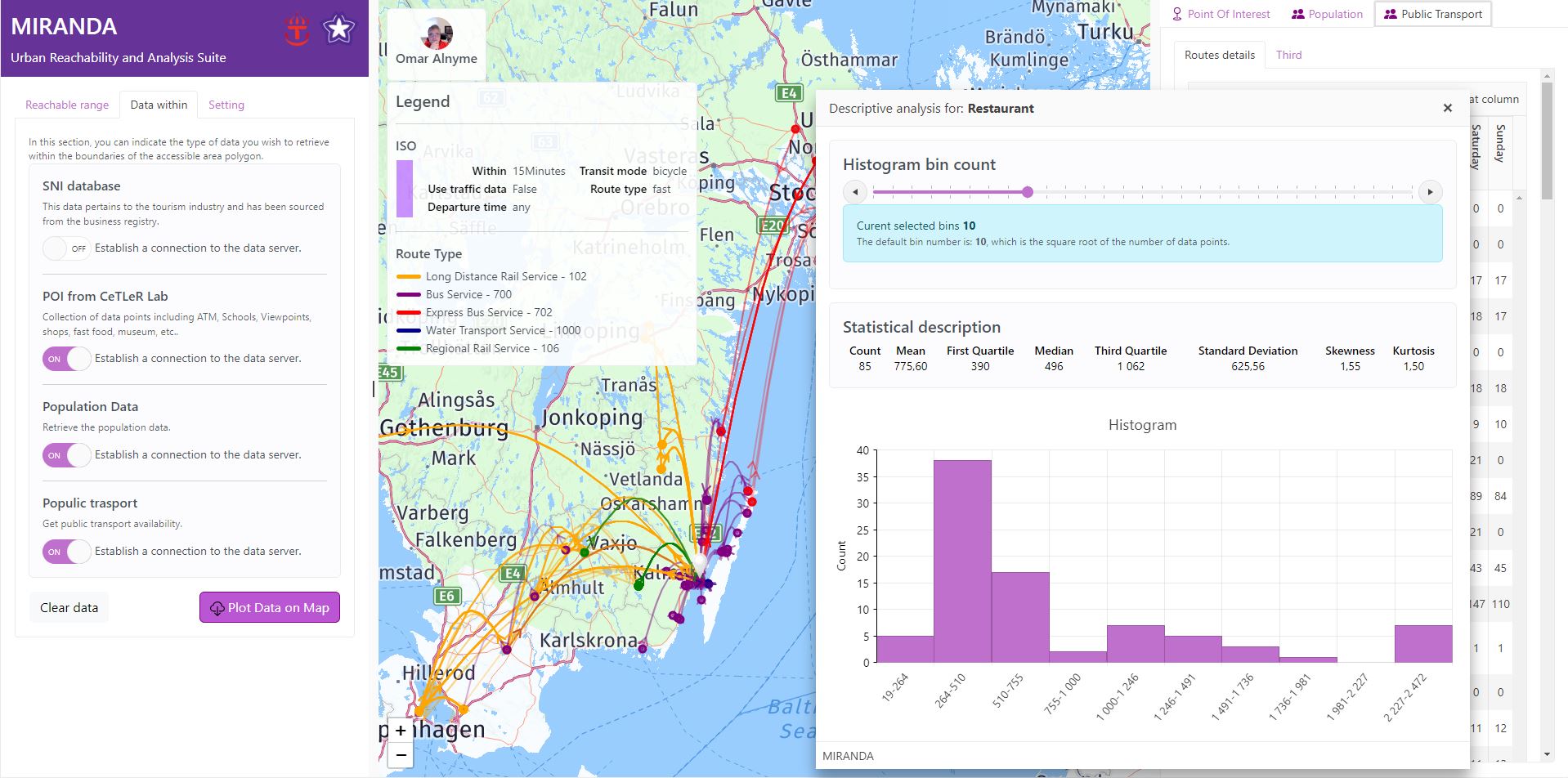
Tillgänglighetsanalys
This model delivers robust analytical capabilities for evaluating spatial accessibility, enabling users to:
- Conduct multi-modal transport analyses, including walking, driving, cycling, and bus across customizable time intervals.
- Enhance precision by integrating historical traffic patterns.
- Extract all points of interest (POIs) within the generated isochrone polygon (ISO) for detailed distance-based assessments from the origin.
- Systematically categorize POIs by industry to facilitate targeted insights.
- Obtain granular demographic estimates, segmenting the population within the ISO boundary into five-year age cohorts (e.g. 0–4, 5–9, 10–14, etc.) for enhanced analytical depth.
- Assess available public transit options and their respective destinations originating from the ISO polygon to support evidence-based transport planning.
GeoTour Data Analytics Model
The model is designed to integrate diverse datasets, enabling a comprehensive analysis of tourism trends, private sector activity, and traffic flow patterns. By consolidating data from accommodation providers, private sector platforms (e.g. Airbnb), micro-level turnover statistics, and traffic flow data from safety cameras, the model facilitates a multidimensional examination of regional dynamics. This framework provides a robust basis for analyzing the interdependencies between these variables, supporting data-driven insights into their interrelated effects.